
Our Region
Learn more about the Torres Strait Region
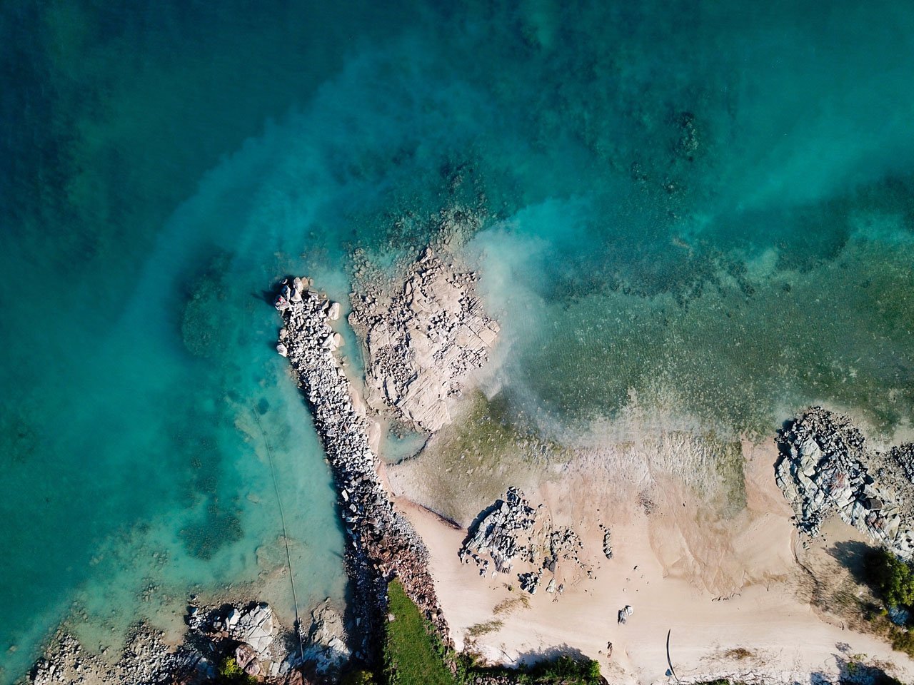
Torres Strait Region
Learn more about our region and uncover the rich history of the Torres Strait.
- The year Spanish captain Torres sailed through the region on his way to the Philippines.
-
1606
- The year James Cook claimed sovereignty over the Eastern part of Australia at Possession Island.
-
1770
- The year Christian missionaries arrive on Erub. The date, 1 July is now celebrated annually across the region as ‘The Coming of The Light’.
-
1871

Useful Information
The Torres Strait, also known as Zenedth Kes, is a strait between Australia and the Melanesian Island of New Guinea. The various Torres Strait Islander communities have a unique culture and long-standing history with the islands and nearby coastlines.
The term ‘Torres Strait Islander’ is used to describe people who come from the islands of the Torres Strait – a section of ocean that stretches from the tip of the Cape York Peninsula in Queensland across to Papua New Guinea. There are almost 300 islands in the Torres Strait, but only 17 of those are populated. Between 8,000 and 10,000 years ago, there was a land bridge between Australia and New Guinea that allowed ancient peoples to travel south from Asia and settle. Rising sea levels at the end of the last ice age flooded the area, leaving only the highest peaks above water. These peaks became the islands we know today.
Facts
Culture
Torres Strait Islanders have a distinct culture which varies slightly within each island or community. The culture is complex, with some Australian elements, Papuan elements and Austronesian elements (also seen in the languages spoken). Like Aboriginal people of mainland Australia, Torres Strait Islanders are traditionally agriculturalists, and food is supplemented through hunting and gathering. Cooking and hunting are synonymous to the Torres Strait culture and is taught from a young age.
Torres Strait Clusters
The Torres Strait is divided into five major island clusters:
- Top Western Group (Boigu, Dauan and Saibai)
- Near Western Group (Badu, Mabuiag and Moa)
- Central Group (Iama, Warraber, Poruma and Masig)
- Eastern Group (Mer, Ugar and Erub)
- Inner Island Group (Thursday, Horn, Hammond, Prince of Wales and Friday).
Languages
The Torres Strait is divided into five major island clusters:
- Top Western Group (Boigu, Dauan and Saibai)
- Near Western Group (Badu, Mabuiag and Moa)
- Central Group (Iama, Warraber, Poruma and Masig)
- Eastern Group (Mer, Ugar and Erub)
- Inner Island Group (Thursday, Horn, Hammond, Prince of Wales and Friday).
Frequently Asked Questions
Resources on the Torres Strait can be found at Council’s Indigenous Knowledge Centres (IKC’s) located at select communities. More information on IKC locations and resources can be found here. You can also contact your Divisional Councillor or local council office for more information.
Prior permission is required to enter communities within the Torres Strait Island Regional Council footprint. Visit here for more details.